SAT NAV GPS navigation

devon.john

Club Member
SAT NAVS
i have had a few over the years Garmen ,,tom tom ,,,both didin last long ,,water ingress and just failing ,
5yrs ago i bought a cheap FODSPORT M5S this is a basic GPS navigation worked really well doing what i wanted ,, .
it has failed on the touch screen ,,(5years old )
i have replaced it with the same £120 with all the connection for a bike ,,but now can wire two bikes as i have the extra fittings ,,
so if you looking for a sat nav they are good value
China made but so are all the others out there
 
Last edited:
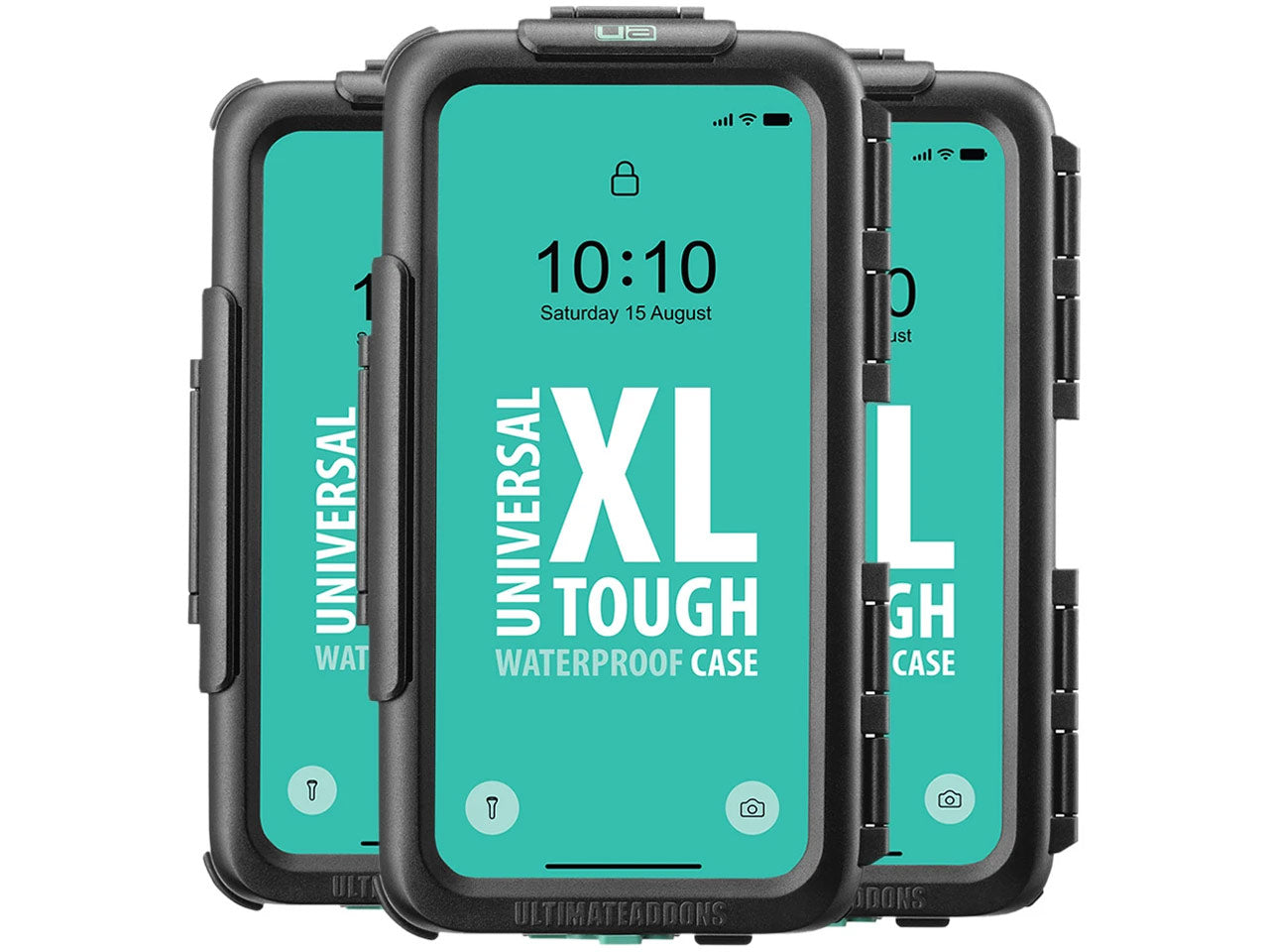
For the rare ocassion when I need satnav on a bike I use Waze on my phone mounted with one of these.


Warns you nicely of all the mobile speed traps too, not that it's a problem on a Shovel. 🤣
 
For the rare ocassion when I need satnav on a bike I use Waze on my phone mounted with one of these.


Warns you nicely of all the mobile speed traps too, not that it's a problem on a Shovel. 🤣
no good to me to small and to fiddly
5" screen that i can read ,,,
 
Ive used a rider550 for a few years now.
Pricey, but very good. Got 2 docking stations, so move it between the bikes.
 
A lot of people use their phones but I've not had good experience with mine (varios iphone models). Great in the car as Waze will help you avoid traffic jams etc) but I've tried my phone mounted on the bars three times. First time was on a Dyna and I couldn't see the bleedin' thing for the vibrations when at junctions etc. and twice when abroad when the phone just shut down due to the extreme heat. Dunno if anyone else has had similar issues, but I wouldn't rely on mine except for emergencies.
 
When we plan trips to various parts of Europe stopping over in small sleep villages ( felt a Sabbath song coming on there ) my wife prints photos off showing the village and the hotel this is kept in our tour pack and it gives me a heads up of what I should be looking out for
 
When we plan trips to various parts of Europe stopping over in small sleep villages ( felt a Sabbath song coming on there ) my wife prints photos off showing the village and the hotel this is kept in our tour pack and it gives me a heads up of what I should be looking out for
i use the google maps and like Malton where the international is this year ,,looked at the town and where things were ,,,
 
People pick their favourite flavour and stick with it.

My last journey using a TomTom on the way out of the village the road was blocked and I had to divert round it. As I made a few turns so it recalculated the route. Turned on the unit for the home bound journey and it reported the road was closed and gave me the alternative route instead.
 
Wonder how many in here could still use a 6 figure grid…….with_glasses
All the time, pre-flight planning. Still use map ,compass and stop watch, I can fantasise I'm Alcock and Brown laughing_roll
On the bike ? no, my best biking adventures have been when hopelessly lost or I'll ask someone who looks vaguely sober and intelligent, bit tricky when touring the north west highlands 😂
 
I use the Beeline. It's not perfect but it's easy to move between bikes. It seems to get confused if the mobile phone signal is poor (it connects via a phone) and or if there are too many stops planned (eg 5-10 stops). It doesn't seem to like going across country borders in Europe, but that could be a phone connection / network issue.
Some people seem to have travelled half way across the world with it, so there could be an issue with the connection to my Samsung. I reckon it's pretty good in the UK, especially if on a trip involving 1-2 stops, and it has got me to rallies in Europe.
 
Back
Top